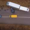
Mobility: Scene Reconstruction

29,804
Reported killed or seriously injured (KSI) casualties (GB, 2022)
£3.5bn
Human costs for serious casualties in road accidents (GB, 2020)
Over 50%
Of road traffic deaths are vulnerable road users (VRUs) (WHO, 2022)
Combining in-vehicle camera footage, GPS data, and our Behaviour AI models, we provide usable insights at speed for accurate road scene reconstruction – support insurance requirements on demand to help you understand the root cause of incidents and prevent unnecessary downtime, and make insurance claim reporting more efficient.
REDUCE VEHICLE DOWNTIME
-
Preempt unplanned vehicle downtime by removing unnecessary delays after an incident and speeding up post-incident reporting.
-
Extract critical information accurately and quickly, including facts on what happened, why and actions the driver could have done to avoid the incident.
EXONERATE DRIVERS
-
Access detailed incident reconstruction reports, including graphical representations of directional pathways of the vehicles involved, their speed, and severity of impact to help prove the root cause of a crash.
-
Receive trustworthy video-based evidence, which helps provide evidence when a driver is not at fault.
SETTLE INSURANCE CLAIMS FASTER
-
Create a win-win situation for fleet owners and insurance companies who want an effective and efficient way of settling insurance claims faster.
-
Our video-based data points are designed based on evidence required by insurance companies and support first notification of loss (FNOL) reports.
TRANSPARENT, TRUSTWORTHY DATA
-
We carefully model our computer vision software so that you can understand how and why our AI has come to a specific conclusion, which means the data and insight we extract are transparent and trustworthy – a key factor in reporting, submitting claims, and meeting regulatory requirements with scene reconstruction.
Each Incident Reconstruction Report includes:
-
Time and Date
-
GPS Location and Address
-
Duration
-
Directional path of the ego vehicle and any incoming object(s)
-
Velocity estimations of both ego vehicle and incoming object(s)
-
G-force values to measure the severity of impact before, during and after incident
-
Distance and orientation of incoming object
-
2D bounding boxes of all objects in the video
-
3D bounding boxes for all vehicles in the video
Integrate our modular technology into your telematics solution via our cloud platform or an SDK – at a fraction of the cost to develop this tool in-house.
Rapid response for incidents and support for drivers

Decreasing vehicle and fleet downtime

Efficiency in incident reporting and insurance claims

Core problems the Scene Reconstruction product addresses:
Scene Reconstruction Package
An ideal solution for those looking for an easy and faster way to support post-incident reporting and insurance claims. Read more →

To bring their next generation dashcam to life, Nextbase sought a software partner who would deliver on accuracy, speed, and ease of integration and use.
Read the full Nextbase case study →
Traffic Management, Analysis & Monitoring

1.35m deaths
on the world’s roads annually
148 hrs lost
due to congestion in London (2021)
$53b cost
to the US due to congestion (2021)
Using pioneering Behaviour AI, we offer traffic management and monitoring providers a much needed layer of human context to enrich current intelligent transport systems (ITS). By quickly understanding the ‘why’ behind the how, where and when people move, cities can make de-risked planning and investment decisions, and roll-out citywide initiatives with confidence.
Humanising Autonomy’s Traffic Management Solution helps spot traffic patterns sooner, and gives context behind risky incidents happening across cities, to help make faster and smarter urban planning decisions.
REDUCE ROAD INCIDENTS AND CRASHES
-
Understanding how and why near miss events happen – and how many and which type of road users were involved.
-
Support VisionZero initiatives: understand crash analytics and risks to better inform decisions.
NEW ROAD USER INSIGHT
-
Understand and predict the behaviour of specific or new road user types to optimise traffic flow by understanding the usage of space (paths) of objects.
-
Avoid costly decisions based on outdated insight and stay ahead of emerging trends.
DE-RISKED DECISIONS
-
Extract relevant historical patterns of how and where objects (vehicles and people) move to unlock powerful movement strategies for city planning purposes, and improve the city’s infrastructure.
-
Improve ROI on investments.
DECREASED TRAFFIC CONGESTION
-
Better inform intelligent transport systems (ITS) with user behaviour insight e.g. crowding at transport hubs, crossing intent in specific zones of interest, and near misses.
-
Spot causes of traffic congestion to better address them.
Humanising Autonomy’s Behaviour AI software uses computer vision to extract trustworthy insight and provide valuable context behind risky incidents, traffic congestion areas and road crashes – with the capability of differentiating traffic and movement patterns by road user type.
Integrate our modular road traffic management technology into your traffic solution via our cloud platform or an SDK – at a fraction of the cost to develop this tool in-house.
Improved safety and reduced accidents

Optimised traffic flow and improved inclusivity

Cost-savings and better informed decisions

Core problems we solve for
traffic management customers:
traffic management customers:
Traffic Management Package
An ideal solution for city solution providers looking to add pioneering technology into their platforms, and for city leaders looking to make their roads safer and easier to navigate.
Read more →

The mobility expert that needed scaled insight for new customers: After a successful proof of concept, Company S continued working with Humanising Autonomy to access valuable information on the mobility and safety within their city that could improve decision-making around traffic flow and road safety. Using CCTV and other infrastructure cameras installed at different points, they can see what’s happening with traffic patterns, crashes and other road user patterns across multiple junctions and roads, across multiple cities, and between different road user types, including pedestrians, bicycles, motorcycles, cars, buses and trucks.
The transport system that needed to update its pattern trends: Company M turned to Humanising Autonomy to explore how they could speedily, effectively, and efficiently use footage from existing CCTV and infrastructure cameras to help evaluate what was happening at its busiest interchanges. Their priority was to work within their existing budget – avoiding the time- and cost-consumption required for new hardware installations. Through our Behaviour AI platform, we helped them extract critical and evolved pattern trends around social distancing, footfall density across specific times and days, and high-risk areas for clustering.
Telematics